Welcome to KQ GEO TECHNOLOGIES
Where Advanced GIS Meets Real-World Impact
We deliver high-performance geospatial platforms, custom solutions, and strategic insights to empower digital transformation across sectors — from smart cities and infrastructure to environmental management and beyond.

Products
With years of experience in geospatial field, KQ GEO has developed our own GIS platforms and a series of products. KQ products are designed to solve real-world challenges with geospatial intelligence for a wide range of industries. You can enjoy the smartness brought by KQ products here.
A comprehensive GIS data management software that integrates mapping, image processing, analytics, and data management into an intuitive user interface.
A high-performance & enterprise-class system, which enables GIS applications and service publishing and sharing.
A field-ready GIS solution that allows users to collect, analyze, and share spatial data in real time.
It provides advanced 3D visualization and spatial analysis tools, enabling users to interact with geospatial data in a dynamic 3D environment.
A development toolkit that empowers developers to create custom GIS applications tailored to specific industry needs.
A remote sensing platform designed for high-precision satellite imagery and data processing applications.
It leverages artificial intelligence to enhance GIS applications, providing predictive analysis and automation capabilities.
Empowering Decision-Making with GIS Technology
KQ GEO Technologies provides cutting-edge Geographic Information System (GIS) solutions that help organizations manage spatial data, analyze geographic trends, and optimize decision-making across multiple industries.
Our technology supports real-time data visualization, spatial analysis, and smart mapping solutions for various applications.
Solutions
Leverage GIS, remote sensing, and big data analytics to enhance resource management, optimize land use, and support environmental sustainability.
With our advanced geospatial solutions able to monitor and manage natural resources such as forests, minerals, and water bodies. By integrating satellite imagery, real-time data collection, and geospatial analysis, organizations can assess environmental changes, detect deforestation, monitor water levels, and optimize land utilization. These solutions support government agencies and industries in making informed decisions for conservation and resource efficiency.
Natural Resources
Solutions
Leverage geospatial technologies, big data and IoT to know more about agriculture. Improve management level, ensure food safety and increase income.
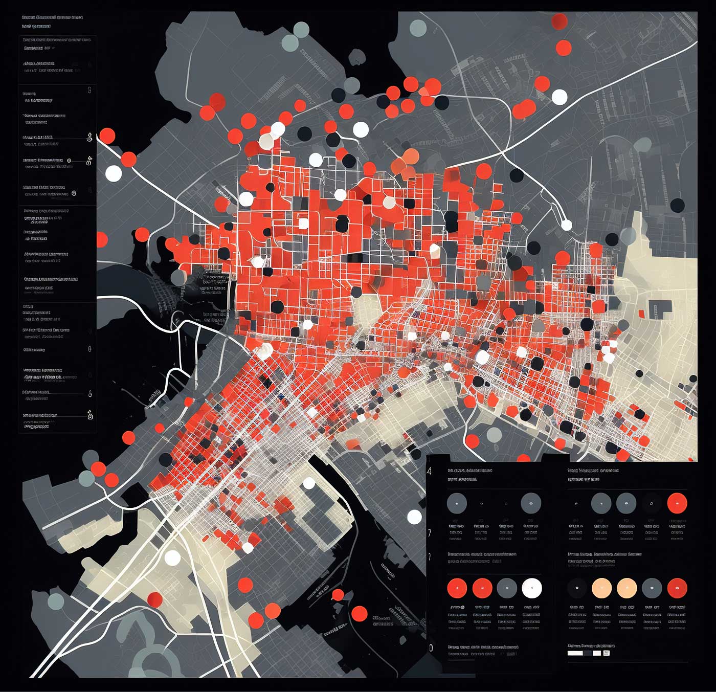
KQ’s smart agriculture solution, built on KQGIS platforms, integrates IoT and other technologies to support farms, management departments, and agricultural parks. It enhances production, marketing, and decision-making while improving disaster resilience, boosting yields, ensuring food safety, and aiding government regulations.
Agriculture
Solutions
Our Smart City solution leverages geospatial information, cloud computing, and IoT to enhance urban management and operations.
It enables real-time data analysis, improving decision-making for enterprises and the public. By optimizing city services and infrastructure, it enhances citizens’ quality of life and supports sustainable urban development.
Smart City
Solutions
KQ leverages KQGIS platforms to support efficient water management and conservation.
It provides systems for water census, water conservancy projects, resource management, and disaster response. These systems enhance monitoring, analysis, and decision-making for water distribution, infrastructure maintenance, and emergency planning, ensuring effective flood prevention and drought relief.
Water Conservancy
Solutions
Apply GIS-based analysis to monitor environmental changes, assess pollution levels, and support ecosystem conservation.
KQ’s ecological solutions help detect air and water pollution, monitor deforestation, and analyze climate change impacts. By leveraging geospatial data, organizations can implement better policies for biodiversity conservation and carbon footprint reduction. These solutions aid in environmental impact assessments and sustainable development initiatives.
Ecological Environment
Solutions
Enhance disaster preparedness and response through real-time GIS monitoring, risk assessment, and predictive analysis.
KQ’s emergency safety solutions integrate GIS and IoT to track natural disasters, industrial hazards, and public safety incidents. These tools help emergency responders map out evacuation routes, optimize resource deployment, and improve crisis management strategies, minimizing damage and saving lives.
Emergency Safety Supervision
Solutions
Support urban development with GIS-based planning, 3D modeling, and infrastructure monitoring.
KQ provides intelligent solutions for construction project management, land zoning, and real estate planning. These solutions enhance project feasibility analysis, optimize land use, and reduce construction risks by offering real-time spatial insights and predictive analytics.
Housing and Construction
Solutions
KQ utilizes advanced technologies to manage and share marine and fishery data efficiently.
It develops platforms for data aggregation, analysis, and synchronization, enabling better decision-making and resource management. These solutions provide comprehensive marine insights for both government agencies and the public.
Ocean
Solutions
KQ integrates KQGIS Desktop with cloud computing, IoT, and other technologies to enhance forestry management.
The solution covers resource supervision, ecological restoration, disaster monitoring, and forest protection. It supports afforestation planning and integrated management, ensuring an ecologically safe and sustainable forestry system.
Forestry
Empowering Decision-Making with GIS Technology
April 24, 2025
April 24, 2025
Categories
Do you like it?
February 28, 2025
February 28, 2025
Categories
Do you like it?
December 22, 2024
December 22, 2024
Categories
Do you like it?
We are trusted by


Unlock Your Business Potential
Elevate your presence with innovative design and strategic solutions. Let’s create something impactful together!
