About
Introduction
Founded in Beijing, China in 2001, KQ GEO Technologies Co., Ltd has always adhered to the platform development strategy of independent and controllable core technology, and carried out product research and development based on 3S (GIS, RS, GNSS) technologies, such as geographic information, remote sensing, and location services.
Now it has become one of the few suppliers of safe, independent and controllable 3S platforms and products in the industry, a provider of information solutions in digital governance and smart industry upgrade for governments, military, enterprises and universities, and also a provider of planning and consulting services for regional economic and social development.
After more than 20 years of accumulation, KQ GEO Technologies has a number of independent and controllable core technologies, and has formed four major platforms: geographic information platform (KQ GIS), remote sensing intelligent service platform (KQ RS), satellite navigation positioning and orientation platform (KQ GNSS), and business collaboration platform (KQ CO).
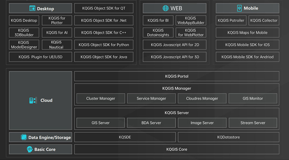
Geographic Information Platform (KQ GIS) is a self-controlled, safe, reliable, and competitive GIS platform developed by KQ GEO TECHNOLOGIES.
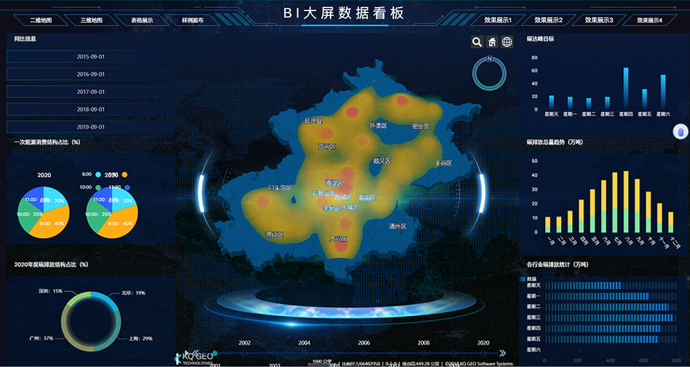
KQGIS platform fully integrates advanced technologies such as big data, cloud computing, Internet of Things, artificial intelligence, etc., and realizes the storage, management, analysis, and application of ultra-large-scale spatiotemporal information, and can provide users with stable, continuous, efficient and secure spatiotemporal information services. Based on a unified GIS kernel, KQGIS has comprehensively improved the technical level of cross-platform GIS, three-dimensional GIS, big data GIS, cloud-native GIS, artificial intelligence GIS, etc., empowering the informatization construction of government, enterprises, and national defense, and meeting the GIS application needs of multiple industries, multiple levels, and multiple users.
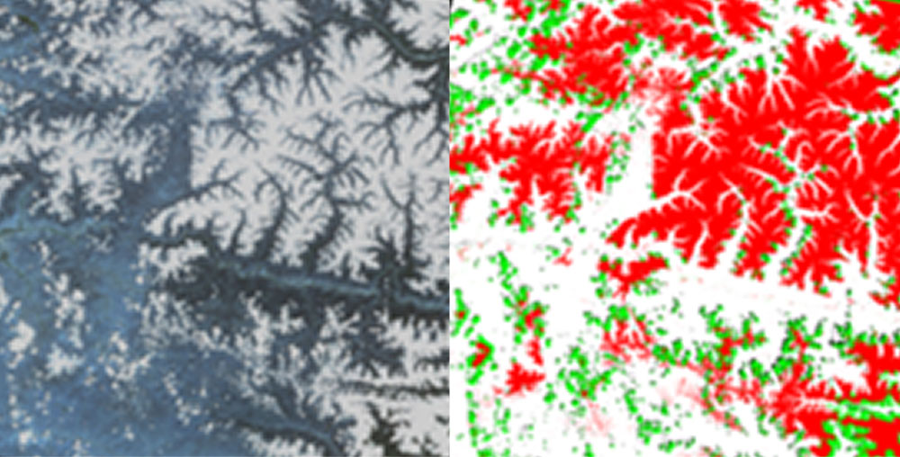
The Remote Sensing Intelligent Service Platform (KQ RS) integrates remote sensing data processing, interpretation, management, application and distribution.
The platform breaks through the bottleneck of massive remote sensing data processing capabilities and algorithm efficiency, can achieve highly automated and efficient processing of various types of payload data such as satellite data and drone data, and can achieve the production of high-precision DOM, DSM, DEM, 3D models, and other surveying and mapping products. The platform can realize distributed elastic storage and management of massive spatiotemporal remote sensing data, and has intelligent interpretation and distribution capabilities of remote sensing images.
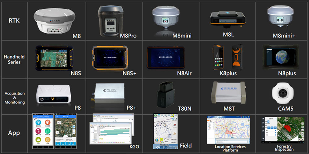
The company has launched a high-precision differential processing system for drone aviation that integrates software and hardware, forming a complete solution from data acquisition to 4D results production.
The company focuses on the research and development and application of GNSS core technologies, with the core of “combining software and hardware, integrating indoor and outdoor operations”, and has successively launched intelligent GNSS receivers, high-precision GIS data collectors, GNSS post-processing software systems, high-precision aviation differential systems, etc., and has obtained a series of technical achievements with independent intellectual property rights, including 15 national patents and 33 software copyrights.

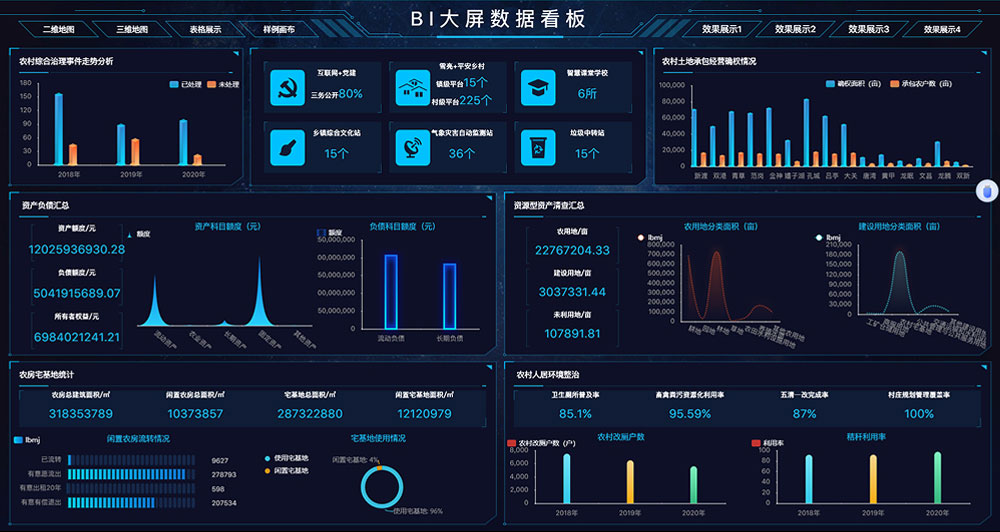
Business Collaboration Platform (KQ CO) is an intelligent, platform-based electronic office product independently developed by KQ GEO TECHNOLOGIES.
To solve the problems of the fixed traditional office environment, complex processes, unrelated images and texts, monotonous portals, unsmooth communication, poor office experience, low-security factors, and slow operation efficiency, KQGIS launched KQ CO V6.2 in 2023, which upgraded from platformization, portalization, mobility and businessization, and brought a new experience to applications in natural resources, smart city, agriculture and forestry, discipline inspection and supervision, national defense and military, and other fields.
Based on its core technology, KQGIS has independently participated in a large number of national and provincial projects, such as natural resources, agriculture and rural areas, planning, water conservancy, emergency management, smart city, surveying and mapping, etc, and been in the leading position in many fields, such as natural resources, real estate, agriculture and rural areas.
For more than 20 years, with the purpose of “Pursuing Excellence and Creating Examples”, KQGIS has been inheriting the “Craftsmanship Spirit”, diving deeper into the 3S fields, focusing on the application research of 3S core technologies, committing itself to becoming a world-class platform enterprise of spatial information technology, and making greater contributions to the high-quality development of the geographic information industry.
KQ GEO Technologies has more than 1,400 professionals, 37 branches at home and abroad (including Malaysia, Indonesia, Hong Kong, China), 4 wholly-owned subsidiaries, 5 technology research and development centers, 2 joint research institutes, as well as 2 surveying and mapping production bases.
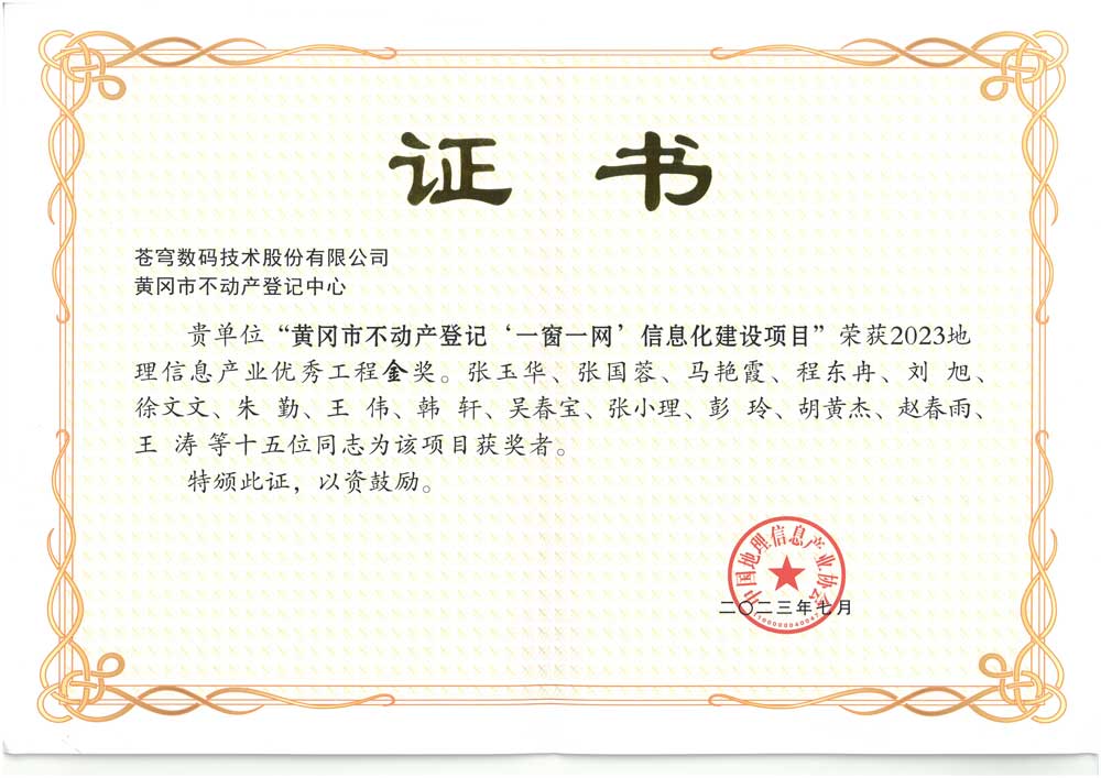
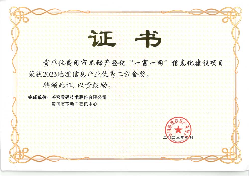
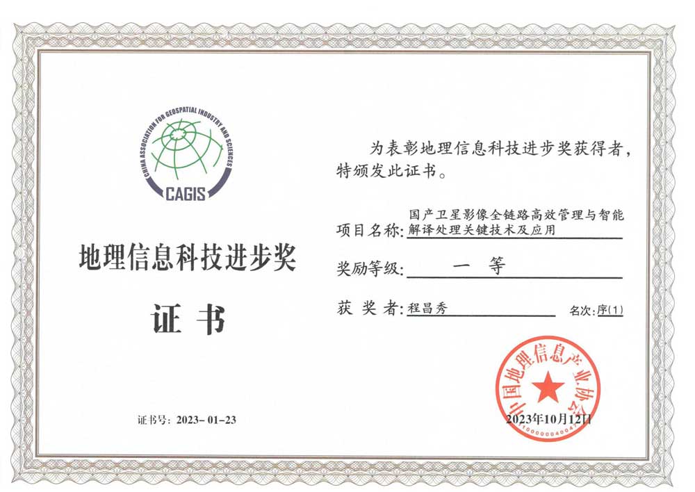
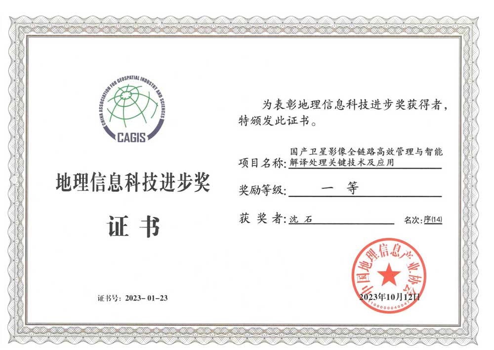
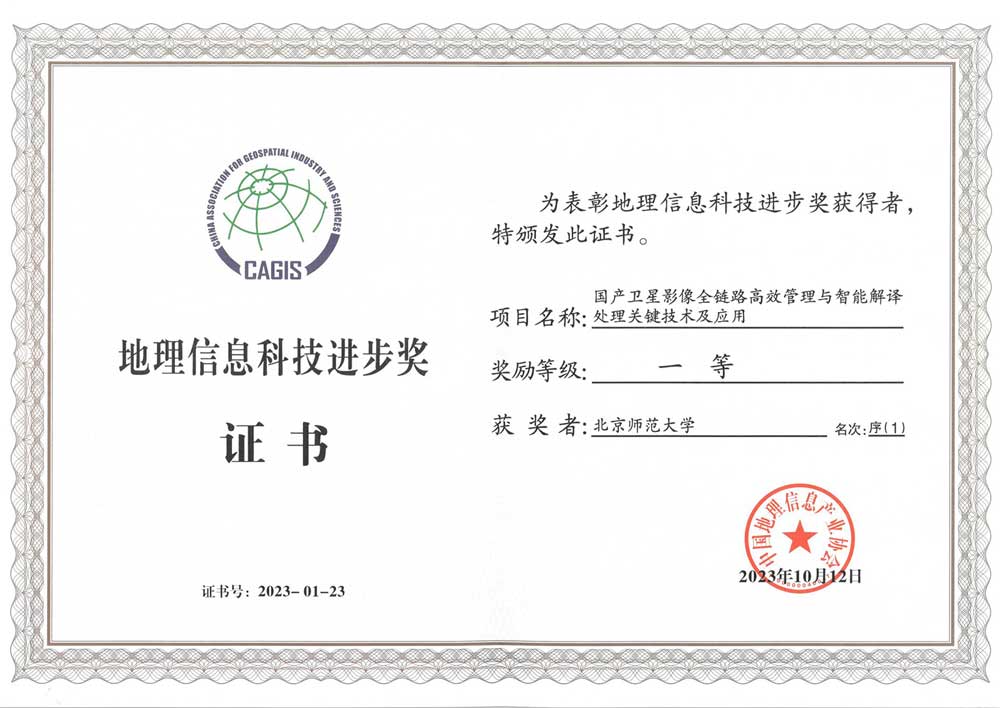
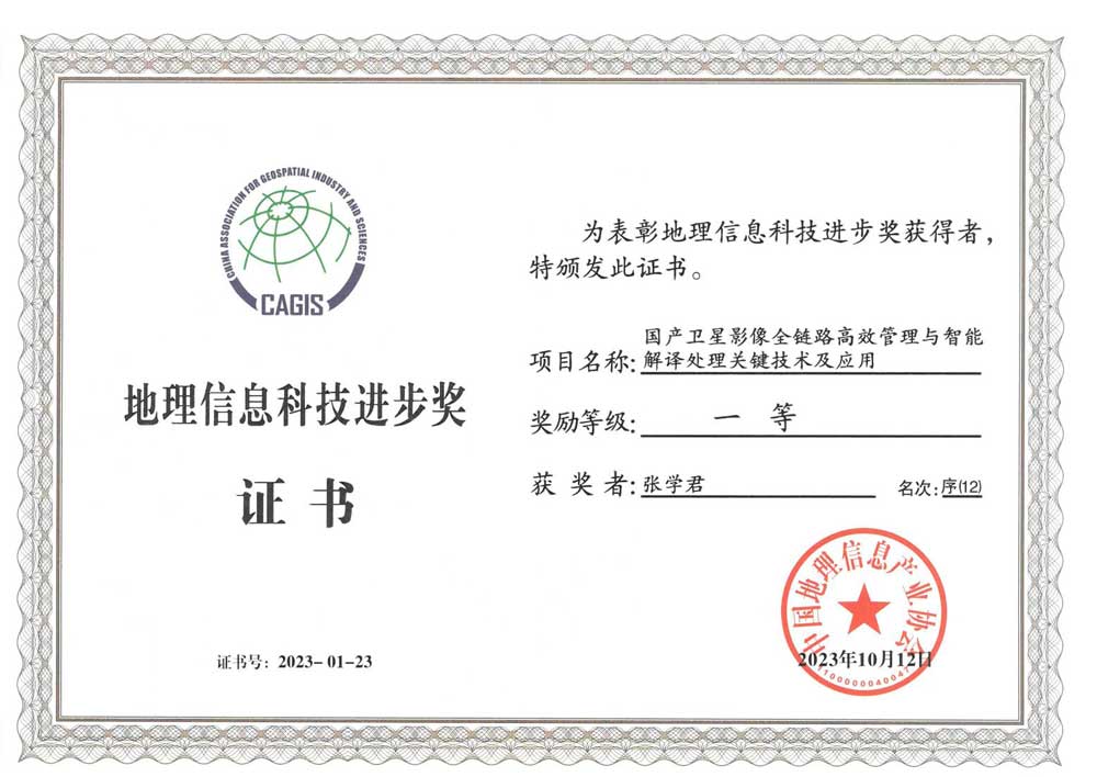
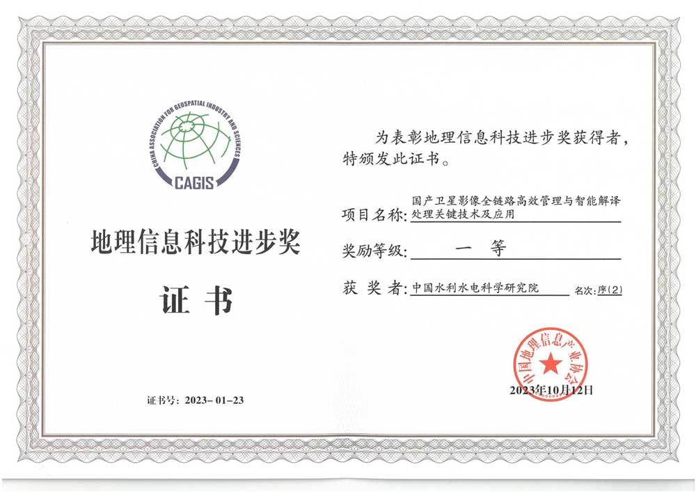
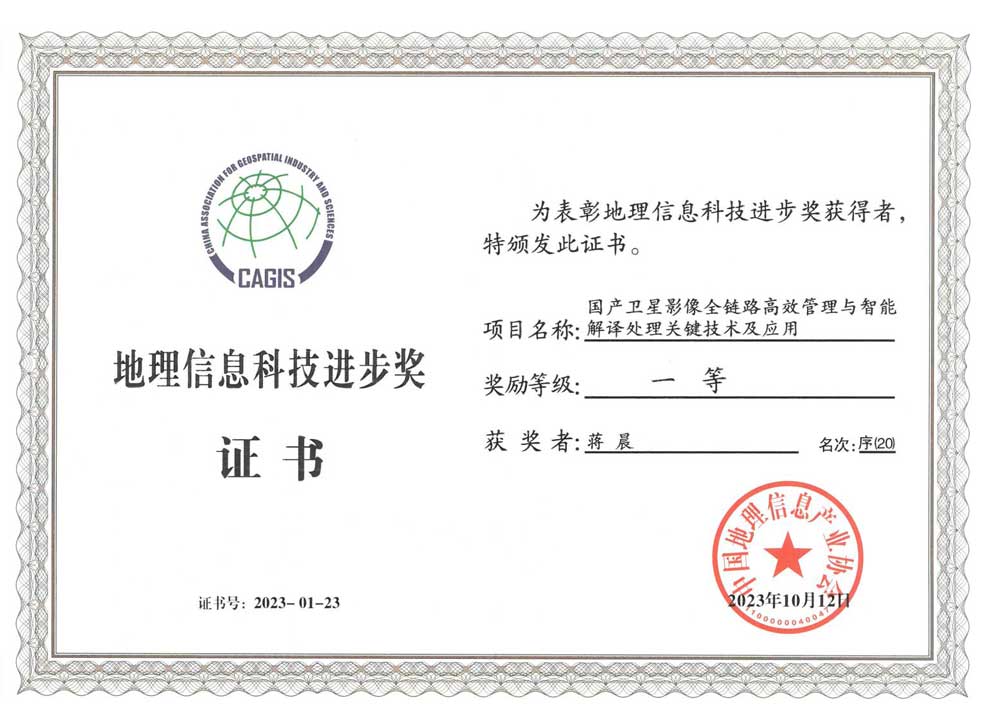
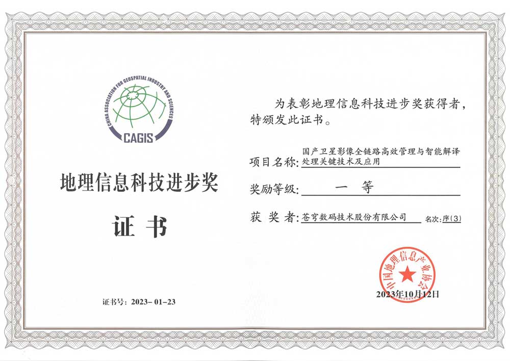
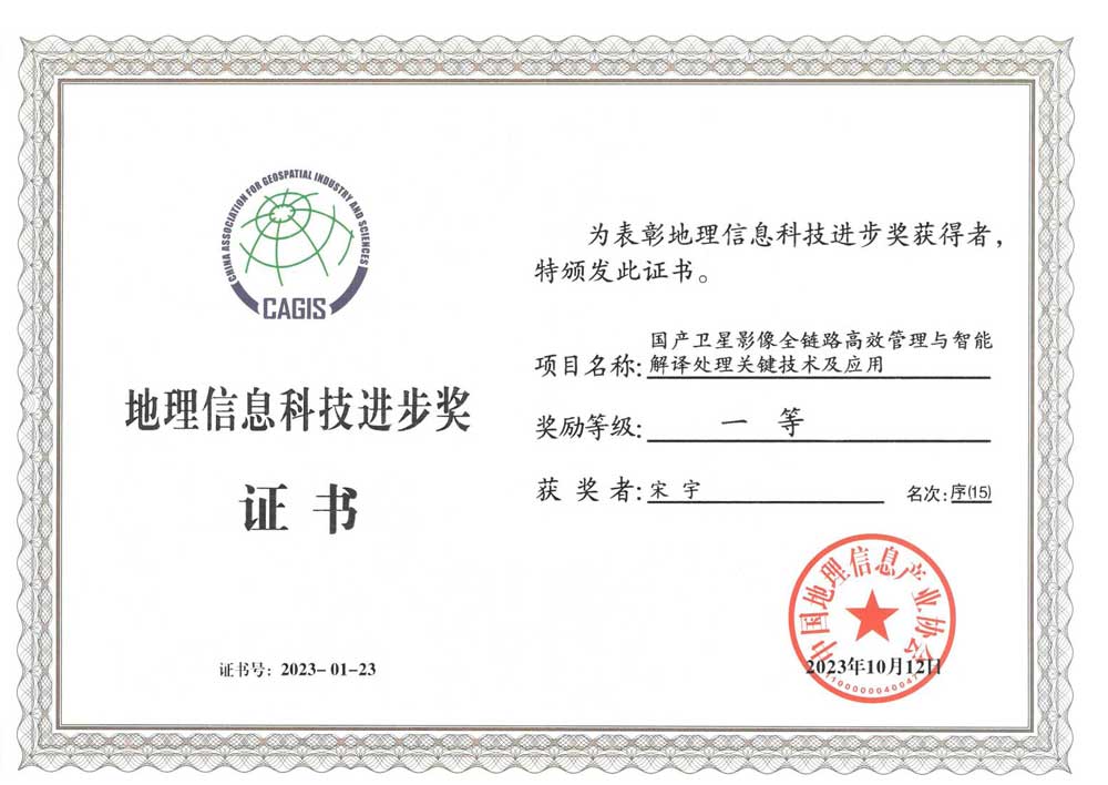
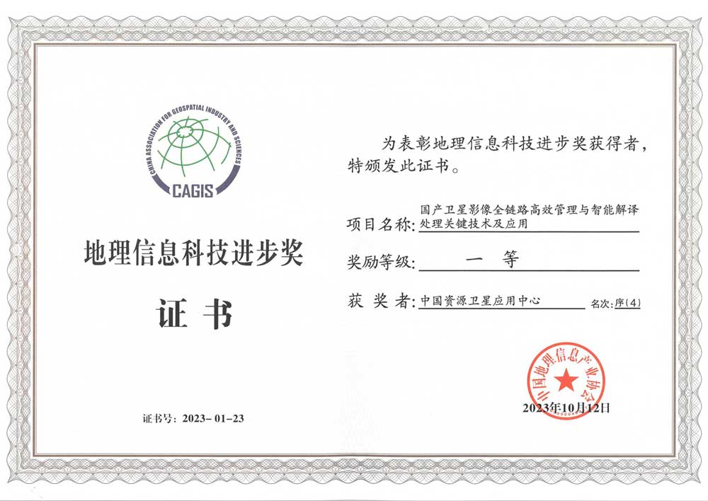
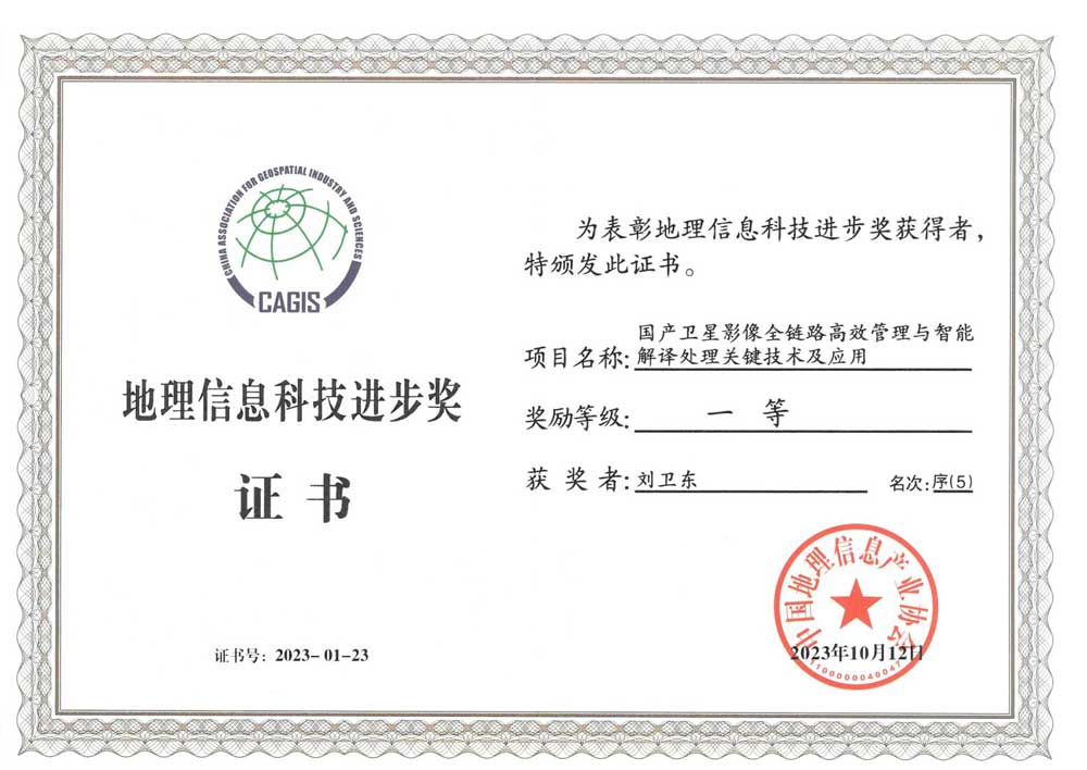
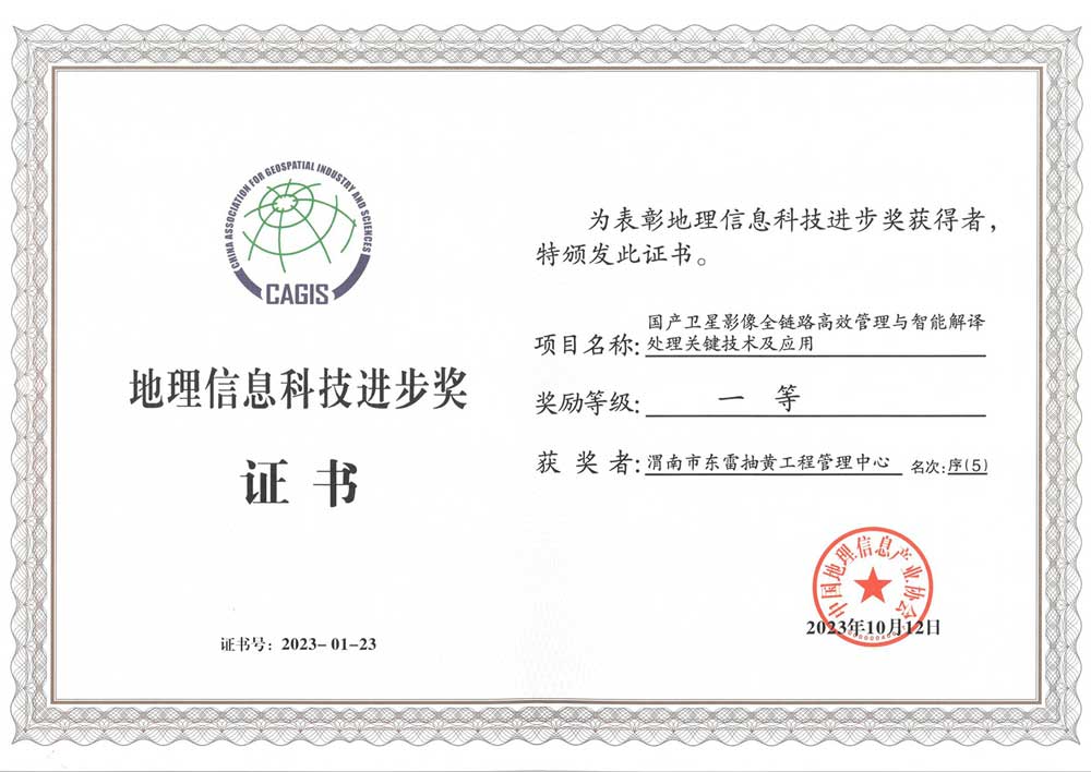
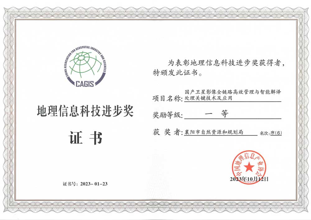
As a national high-tech enterprise, KQ GEO Technologies has consecutively won the titles of “Most Influential Enterprise in China’s Software Industry” and “Top 100 Enterprises in China’s Geographic Information Industry”, and honors of “China’s Geographic Information Science and Technology Progress Award”, “National Excellent Surveying and Mapping Project” and “Surveying and Mapping Science and Technology Award”, as well as some important qualifications of “Class A surveying and mapping qualifications”, “Class A land planning qualifications”, CMMI5, etc. The company has 49 patents, more than 500 software copyright certificates, and has participated in formulating over 30 industry standards.
Qualification & Honor
![[79] 2017 Top 100 Chinese Software and IT Service Companies by Overall Competitiveness (Plaque)](https://kqgeo.net/wp-content/uploads/2025/04/79-2017-Top-100-Chinese-Software-and-IT-Service-Companies-by-Overall-Competitiveness-Plaque.jpg)
![[139]-2019-Most-Influential-Software-and-Information-Service-Enterprise-in-China](https://kqgeo.net/wp-content/uploads/2025/04/139-2019-Most-Influential-Software-and-Information-Service-Enterprise-in-China.jpg)
![[146]-Top-100-Technological-Innovation-Private-Enterprises-in-Beijing](https://kqgeo.net/wp-content/uploads/2025/04/146-Top-100-Technological-Innovation-Private-Enterprises-in-Beijing.jpg)
![[248]-2024-Top-100-Enterprises-in-the-Geographic-Information-Industry](https://kqgeo.net/wp-content/uploads/2025/04/248-2024-Top-100-Enterprises-in-the-Geographic-Information-Industry.jpg)


Unlock Your Business Potential
For any inquiries or assistance, please don’t hesitate to contact us via email or phone.